1870s
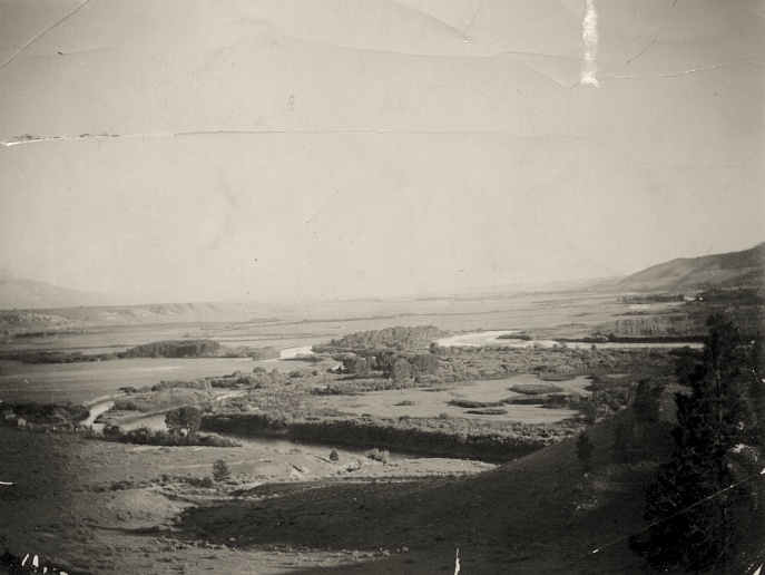
View of the Missouri River and Canton Valley Looking South
from Near Avalance Creek
COURTESY
OF DAN DUKE
Now submerged
beneath the waters of Canyon Ferry Lake, this was the beautiful
landscape through which the westward-bound Lewis and Clark Corps
of Discovery passed in July of 1805. The village of Canton,
Montana, just north of Townsend, was abandoned and subsequently
flooded by the second Canyon Ferry Dam in 1954.
The land
shown is the Thomas Cooney ranch. The Cooneys, a notable Helena
pioneer family, had the distinction of having to twice move
their ranch house to escape rising Canyon Ferry Dam waters.
In 1898, they moved to escape Lake Sewell, the modest lake formed
by the first Canyon Ferry Dam. In 1949, construction of the
massive new dam required a second move to even higher ground.
Area
Gold Mining
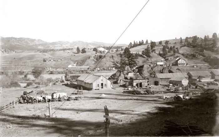
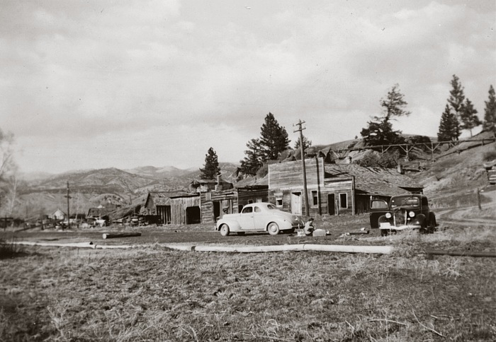
Early
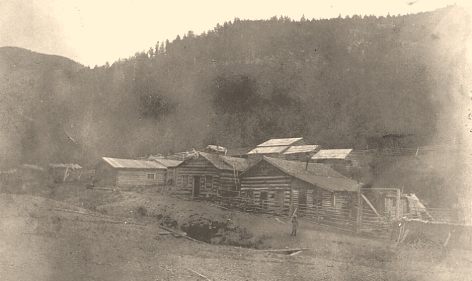
Photograph of White's City
COURTESY
OF DAN DUKE
White's
City was a small placer mining settlement in the Big Belt Mountains,
thirteen miles east of the present-day Canyon Ferry Dam.
By 1865,
gold was being recovered from numerous stream-bottoms in Big
Belt mountain gulches east of the Missouri River, and was also
being found in gravel bars along the river, most abundantly
at French Bar, located 1.25 miles below the present dam.
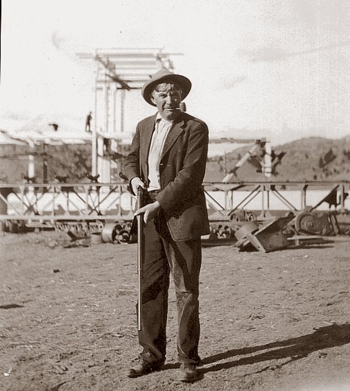
Among the
men who mined the riverbanks for gold was Thomas Cooney, Jr.,
son of the pioneer rancher. Tom Jr. is shown below with his
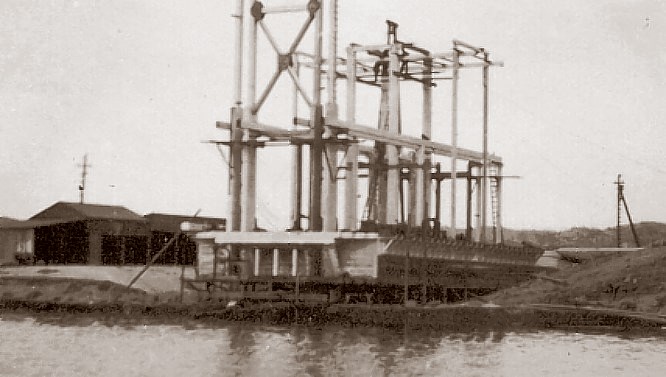
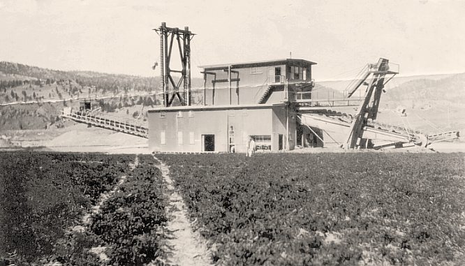
under-construction gold dredge "The Emma". Workers
can be seen on the frame of the dredge....
Thomas Cooney, Jr.
COURTESY
OF DAN DUKE
Thomas
Cooney was a rancher, miner, and served as Lewis & Clark County
Commissioner.
"The
Emma" Under Construction
COURTESY
OF DAN DUKE
"The
Emma" At Work
COURTESY
OF DAN DUKE
COURTESY
OF DAN DUKE
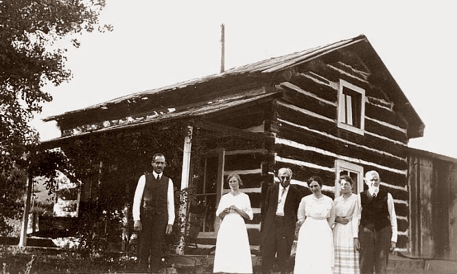
The
Thomas Cooney Ranch House at Magpie Gulch
COURTESY
OF DAN DUKE
Canyon
Ferry
THE
RAY AND PHIL JEZICK COLLECTION, COURTESY OF CHUCK JEZICK
CLICK ON IMAGE FOR A BIG VERSION IN A NEW WINDOW
From
"Helena - An Illustrated History" by Vivian Paladin
and Jean Baucus (1983, Bar-Wineglass Publishing Co., Helena)
"The
old settlement of Canyon Ferry was established by John Oaks
early in 1865. Miners of Confederate, Magpie and Cave gulches
had to come to this point to cross the Missouri, and rowing
across the river was hard work. In 1866 Captain J. V. Stafford
bought out the ferryboat interest and built a hotel and store
there. He soon sold out to Court Sheriff, who operated a general
merchandise business in Cavetown at that time. After the purchase
from Captain Stafford, Sheriff opened a livery stable and hotel,
and this then became known as Canyon Ferry."
For some
50 years, the Sheriff family operated a stagecoach between White
Sulpher Springs and Helena. Canyon Ferry was a meal station
midway along the trip. The stagecoach is seen in both photgraphs
of the ferry below.
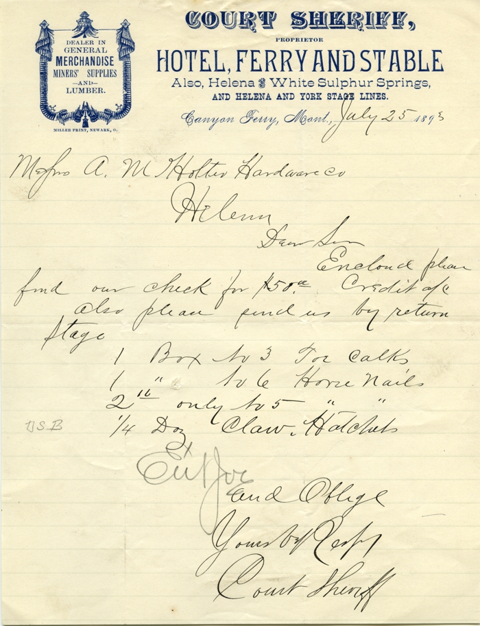
Court Sheriff Order to Holter Hardware Co., 1893
KENNON BAIRD COLLECTION
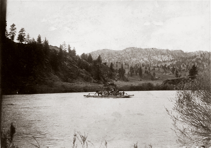
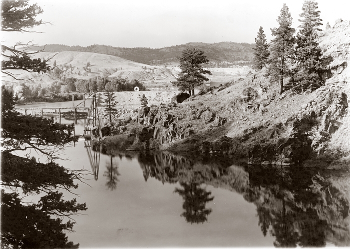
The Ferry In Action
THE
RAY AND PHIL JEZICK COLLECTION, COURTESY OF CHUCK JEZICK
CLICK ON IMAGE FOR A BIG VERSION IN A NEW WINDOW
The ferry
was a reaction ferry, a type of cable ferry that uses
the reaction of the current of a river against a fixed tether
to propel the vessel across the river. It operated using an
overhead cable suspended from towers anchored on either bank
of the river. On such ferries, a "traveller" is usually
installed on the cable and the ferry is attached to the traveller
by a bridle cable. To operate the ferry either the bridle cable
is adjusted or a rudder is used, causing the ferry to be angled
into the current, and the force of the current moves the ferry
across the river.
COLLECTION
OF KENNON BAIRD • CLICK ON IMAGE FOR A
BIG VERSION IN A NEW WINDOW
1952
History of Canyon Ferry, Spotlighting the Sheriff Family from the Independent Record CLICK
ON IMAGE TO OPEN PDF FILE
PART II -- THE FIRST CANYON FERRY DAM, 1898
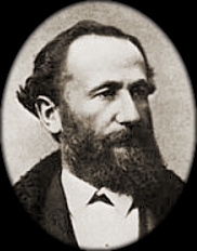
Built by
Samuel T. Hauser
(1833-1914)
CLICK
ON IMAGE FOR A BIG VERSION IN A NEW WINDOW
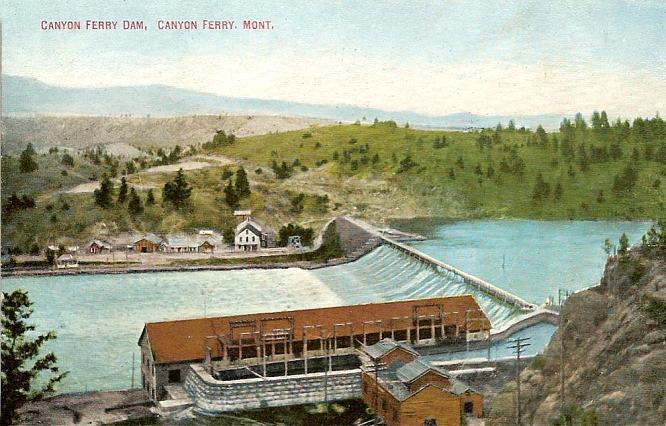
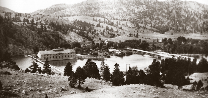
Built by
Samuel Hauser's Missouri River Power Company from 1896-98, this
dam generated 7,500 kilowatts of electricity for Helena and much
of central Montana. The reservoir created by the dam was dubbed
Lake Sewell,
The ferry itself was in operation until 1901, when the steel bridge
below the dam was completed.
First
Canyon Ferry Dam Under Construction, Circa 1897
COLLECTION
OF KENNON BAIRD • CLICK ON IMAGE FOR A
BIG VERSION IN A NEW WINDOW
The
Powerhouse Under Construction
COLLECTION
OF KENNON BAIRD • CLICK ON IMAGE FOR A
BIG VERSION IN A NEW WINDOW
The
Village of Canyon Ferry and Construction Supplies Looking east from the west bank
COLLECTION
OF KENNON BAIRD • CLICK ON IMAGE FOR A
BIG VERSION IN A NEW WINDOW
Looking
North from Above the Dam During Construction
COLLECTION
OF KENNON BAIRD • CLICK ON IMAGE FOR
A BIG VERSION IN A NEW WINDOW
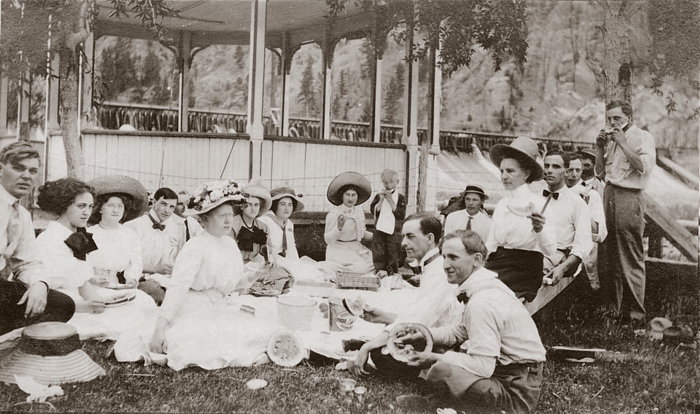
A Picnic at Canyon Ferry Dam, ca. 1900
COURTESY
OF THE DAVID POOR COLLECTION • CLICK ON
IMAGE FOR A BIG VERSION IN A NEW WINDOW
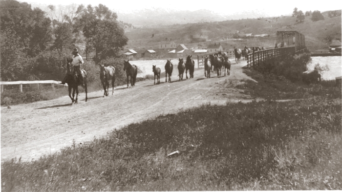
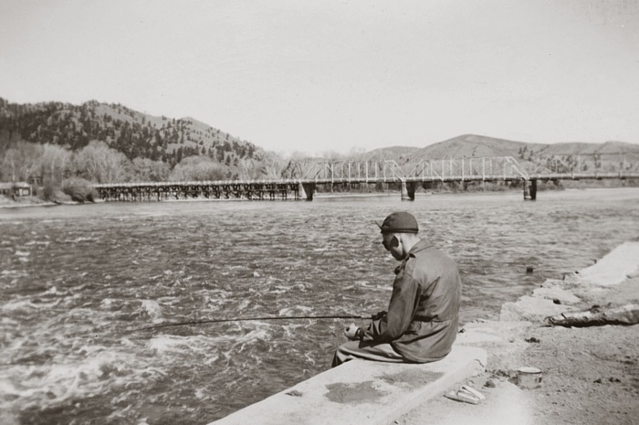
Canyon
Ferry Bridge, 1901 - 1950
COURTESY
OF DAN DUKE • CLICK ON IMAGE FOR A BIG
VERSION IN A NEW WINDOW
1906 photo of
Fred Cooney leading horses across the Canyon Ferry bridge.
The bridge,
which replaced the old ferry in 1901, was located just below the
first dam. It was dismantled in May of 1950, and the site is now
under water.
Canyon
Ferry Bridge, 1947
COLLECTION
OF KENNON BAIRD
COLLECTION
OF KENNON BAIRD
Old buildings at Canyon Ferry, 1947.
COLLECTION
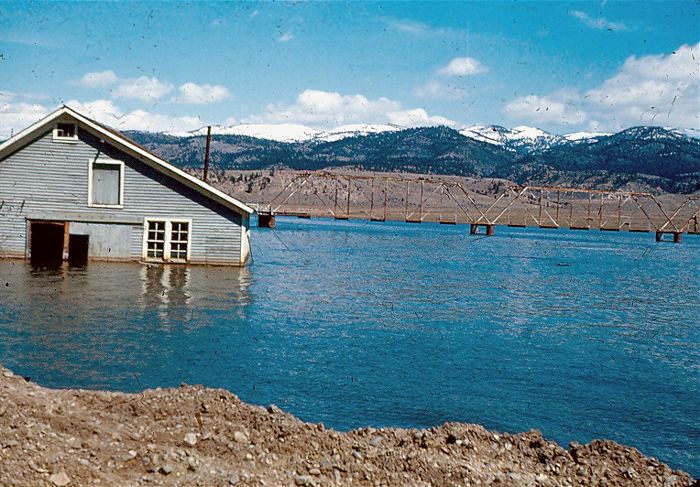
OF BOB & SUSIE LINDEBERG
The Canyon Ferry
Bridge in the rising waters of the new lake, probably early 1950.
PART III -- BUILDING
THE PRESENT DAM
1949-1954
On May 24,
1949, construction of the present Canyon Ferry Dam began about
1.25 miles downstream from the original dam. The new dam was
totally completed on June 23, 1954, but it began generating
electricity earlier, on December 18, 1953. The old Canyon Ferry
Dam and power plant were dismantled prior to the completion
of the new, with some remnants being submerged under the rising
Canyon Ferry Lake.
Unlike the
first dam, the new one was not built with private funds, but
with federal Bureau of Reclamation dollars. Construction was
authorized by the Flood Control Act of December 22, 1944.
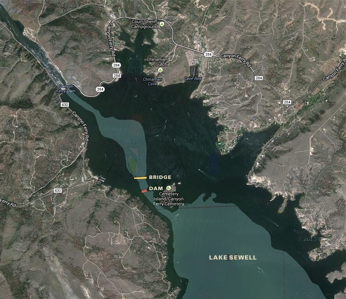
Recent
Satellite View Overlaid with the 1898-1954 River Course
Showing the Location of the Original Dam, Bridge and Lake Sewell
Submerged
under the new Canyon Ferry Lake were several prehistoric Indian
camp sites, three Lewis and Clark camp sites, a stage road, several
old mining towns, and dozens of picturesque ranches and log cabins
dating from the post Civil war era.
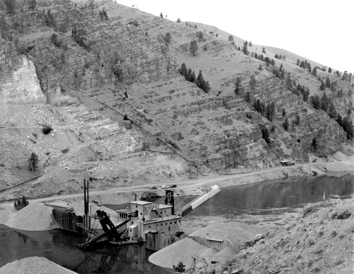
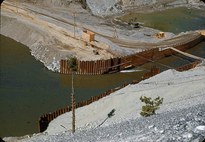
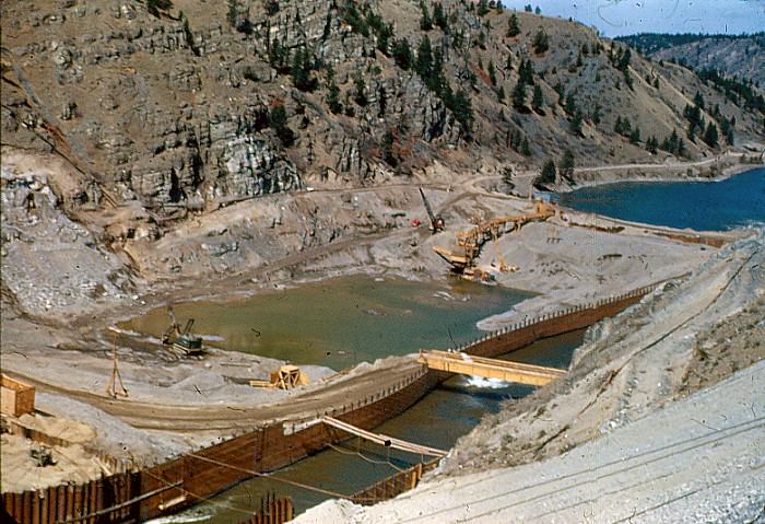
Construction of Coffer Dam
COURTESY
OF JASON FRANCIS
A November
1949 view of the Perry-Schroeder Mining Co. gold dredge, and
the construction of a coffer dam across the Missouri River,
upstream from the construction site. The dredge placed backfill
against the dam.
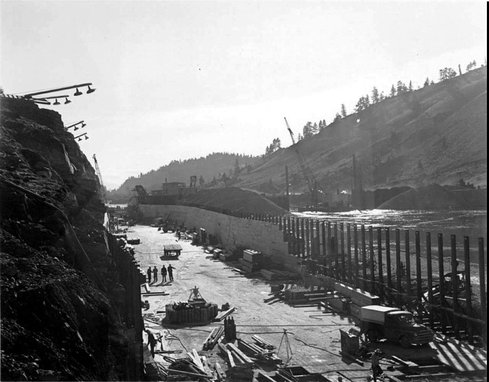
A second
coffer dam was built 1000' downstream. These dams allowed engineers
to divert the river around the construction area through a gigantic
flume, which emptied downstream from the second coffer dam.
This exposed 1000' of dry riverbed for construction of the dam.
BEDROCK EXPOSED
COURTESY
OF JASON FRANCIS
Missouri River
channel bedrock, March 20 1950.
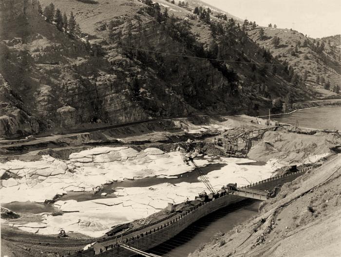
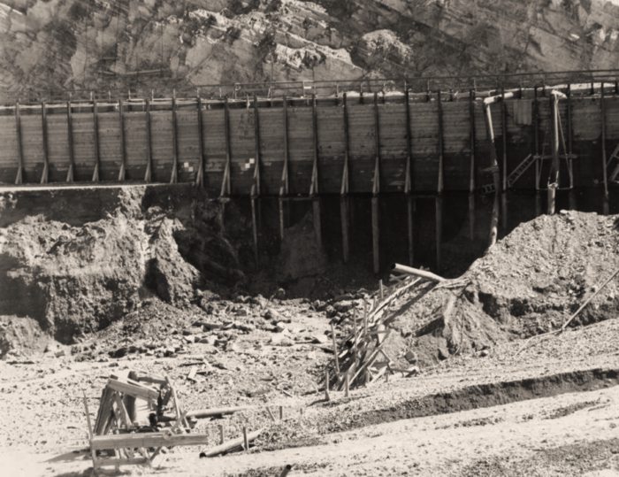
THE FLUME
COURTESY
OF JASON FRANCIS
The flume
was 63' wide, 1000' long, and varied in height from 23' at the
intake to 18' at the discharge. The steel framework of the flume
was covered with three layers: 4-inch-thick wooden planks, building
paper, and shiplap.
It could carry 23,000 cubic feet of water per second.
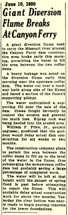
There were
problems with the flume. On June 10, 1950, a section of the
flume near the upstream coffer dam was undermined by high water,
and the construction area was flooded (see clipping below).
On Sept.
11 1950, Canyon Constructors foreman Chandler
Kimsey drowned when he was swept through the flume after
falling out of a small boat.
In April
of 1951, the outlet end of the flume needed extensive bracing
with timbers and concrete because the rushing waters from the
flume had washed away all of the earth fill from under the outlet
end.
COLLECTION OF BOB & SUSIE LINDEBERG
The head of the
diversion flume, summer of 1950.
COLLECTION
OF BOB & SUSIE LINDEBERG
Pumping out the flooded construction area between the coffer dams
after the flume break, summer 1950.
COURTESY
OF JASON FRANCIS
The site of the
flume failure, summer 1950.
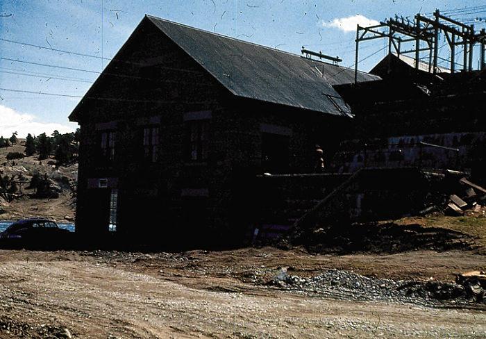
THE OLD POWERHOUSE
COURTESY OF JASON FRANCIS • CLICK
ON PHOTO FOR A DETAILED VIEW OF THE POWERHOUSE
The
first Canyon Ferry Dam powerhouse, June 8 1948, passing 34,000 cubic
feet per second
This photo,
and others in this section, are courtesy of Jason Francis, whose
great-grandfather worked at the old dam. Just a few years after
this photo was taken, the powerhouse was stripped, and now lies
submerged below Canyon Ferry Lake....
COLLECTION
OF BOB & SUSIE LINDEBERG
The last days
of the old powerhouse.
COURTESY OF JASON FRANCIS
The old powerhouse,
stripped down to the stonework.
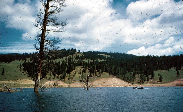
COLLECTION
OF BOB & SUSIE LINDEBERG
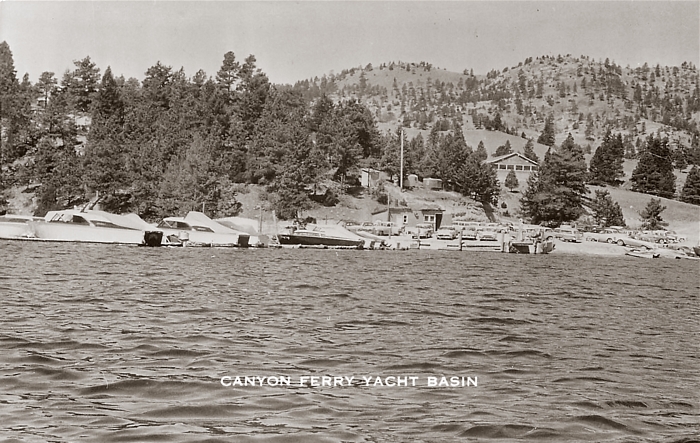
Canyon Ferry Lake
rising
Yacht
Basin, 1950s
Recent Photo of
Canyon Ferry Dam
MINING SAPPHIRES ALONG
EL DORADO BAR - 1972
Between Canyon
Ferry Dam and Hauser Dam is El Dorado Bar, where sapphires have
been mined since 1865. The video clip is taken from the 1973 Helena
Chamber of Commerce promotional film, "Helena - City of Gold".
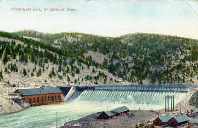
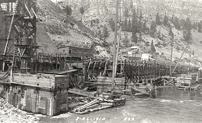
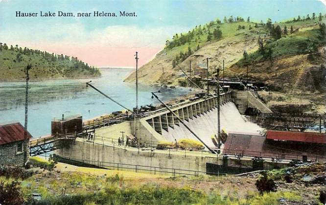
HAUSER DAM THE
FIRST HAUSER DAM BROKE IN 1908
The doomed
Hauser Dam, built from 1905-07. Another project of Samuel T.
Hauser and associates, this dam was funded primarily by the
Amalgamated Copper Company (later the Anaconda Company), who
needed vast amounts of cheap electricity to modernize their
mines in Butte and Anaconda, which were then running on locally
steam-generated electricity.
Despite
the strong objections of his engineer, Martin Gerry, Hauser
chose a design for a steel dam, which proved inadequate against
the power of the Missouri. The dam failed on April 14, 1908
when currents undermined its foundation, which rested on water-impregnated
gravel. The steel plates crumpled, and a 300' wide breach opened
within minutes, sending a torrent of water downstream. It took
the wall of water several hours to reach the town of Craig,
which made notification and evacuation possible.
Twenty-two
miles of Montana Central Railroad track between Wolf Creek and
Cascade were wiped out. Bridge approaches and telegraph lines
were also destroyed. Several buildings in Craig were washed
off their foundations. Some livestock was lost. Great Falls
received 7' floodwaters the next day, but fortunately no lives
were lost in the dam break or the resulting flood.
Samuel Hauser,
who was in New York City at the time of the disaster, was nearly
ruined financially. Amalgamated withdrew their financial support
for Hauser's Missouri River projects, and set about acquiring
the Great Falls Winter Power and Townsite Company. By 1910 creditors
took control of Hauser's Missouri River interests. In 1912,
Butte Electric, which had been supplying steam-generated electricity
to Amalgamated, merged with the Great Falls company to form
the Montana Power Company, which still operates Hauser Dam.
Hauser Dam after
the break, 1908.
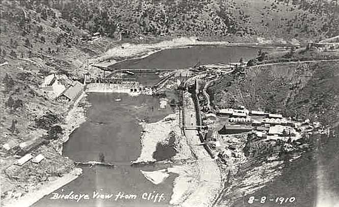
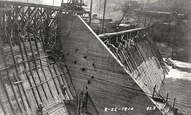
A series of 1910
photos showing construction of the present Hauser Dam.
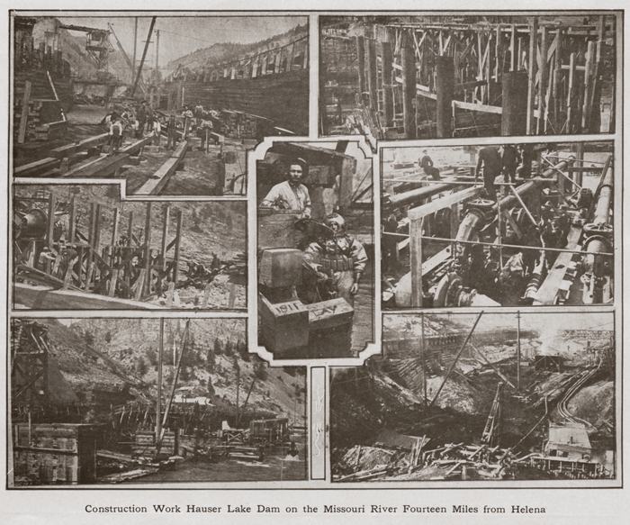
Hauser Dam Construction Vignettes, 1911
COLLECTION
OF KENNON BAIRD
• CLICK ON IMAGE FOR A BIG VERSION IN A NEW WINDOW
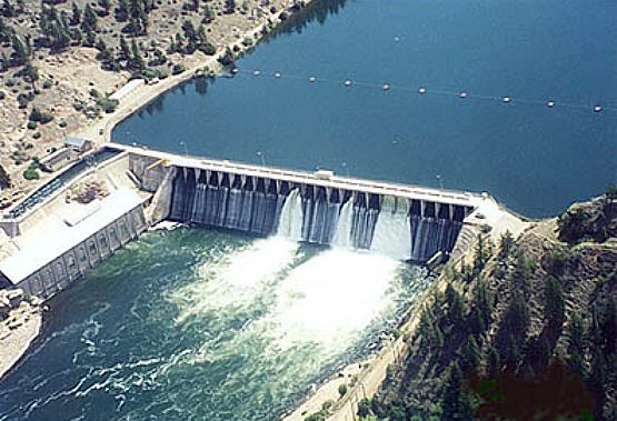
Hauser
Dam today.
HOLTER DAM
STARTED 1909 - COMPLETED 1918
NAMED
FOR EARLY MONTANA ENTREPRENEUR ANTON M. HOLTER
Located
about 30 miles due north of Helena on the Missouri River, Holter
Dam lies some 26 miles downstream from Hauser Dam, and 41 miles
from Canyon Ferry Dam.
Samuel T.
Hauser began construction of Holter Dam in 1909, concurrent
with the rebuilding of his failed Hauser Dam. Design problems,
construction delays and rising costs slowed the project. Hauser's
Missouri River hydroelectric interests were bought in 1911 by
the Butte Electric & Power Co., which in 1912 merged with
the United Missouri River Power Company, the Billings and Eastern
Montana Power Company, and the Madison River Power Company to
form the Montana
Power Company. Holter
Dam began operating in 1918.
These
wonderful 1916-1918 photos of the construction of Holter Dam
are from Tim Rusek. Thanks Tim!
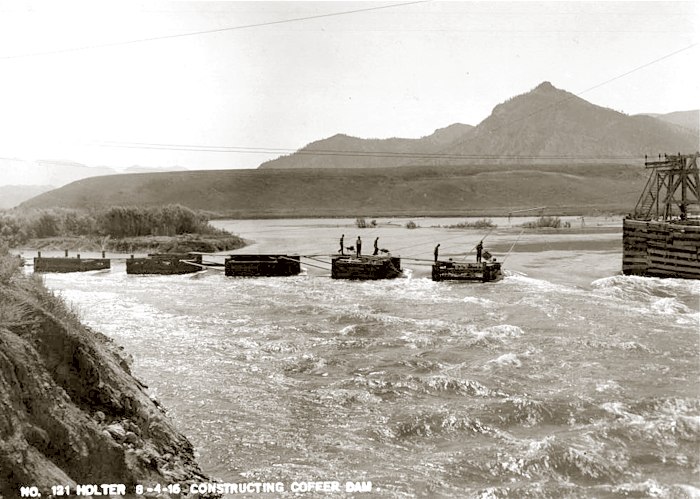
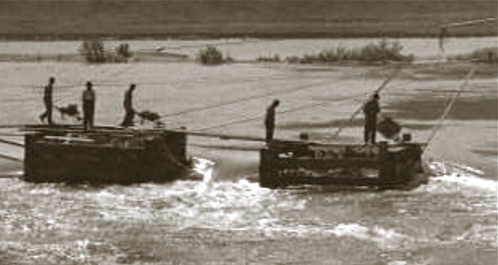
Workers building
the coffer dam, one wheelbarrow full of rocks at a time, in 1916...
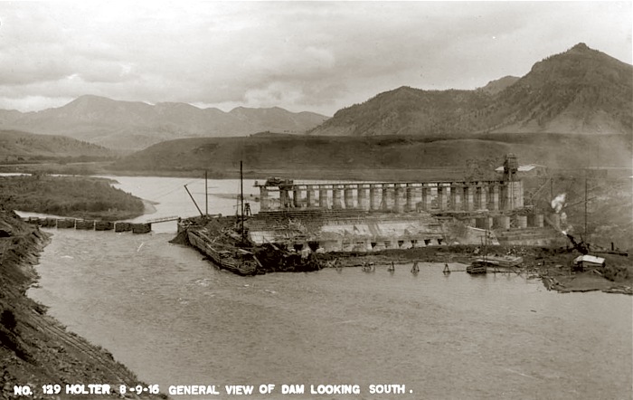
Holter Dam under
construction, 1916.
Holter Dam under
construction, 1916.
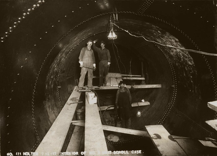
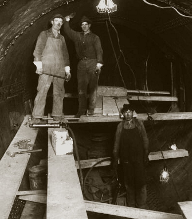
Workers in
the Holter Dam scroll case, 1917. A scroll case is a tapered,
curving tube which channels water from the penstock (the main
pipe carrying water from the reservoir to the generating plant)
into the turbine guide vanes at the optimal angle to maximize
the turbine's efficiency.
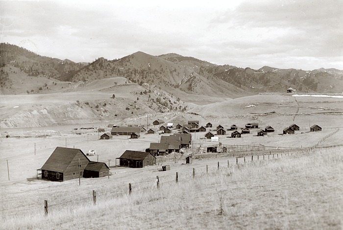
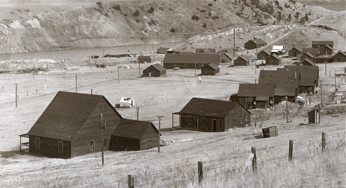
Workers' housing,
west of the dam, 1917...
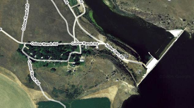
The site of the
workers' camp today, on Oxbow Ranch Rd...
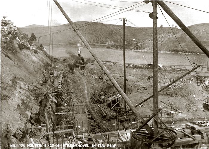
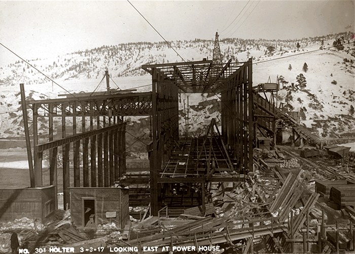
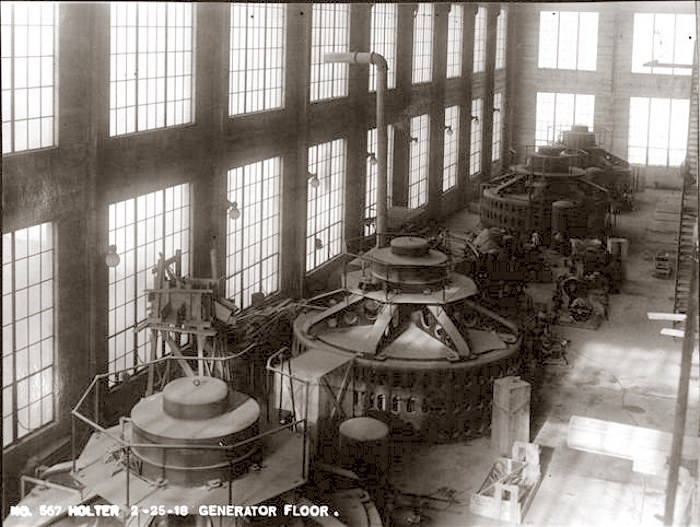
Construction of
the power house, March 1917.
Dam construction,
looking west , 1917.
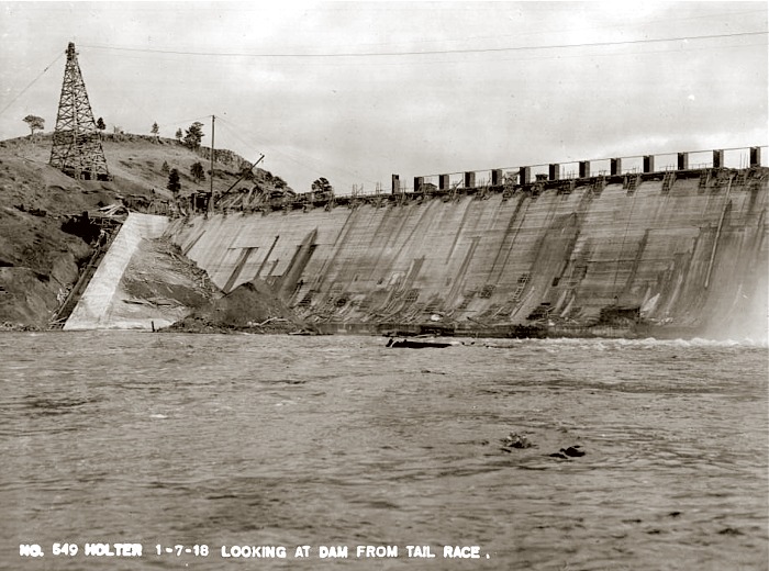
View of the nearly-completed
dam, January 1918.
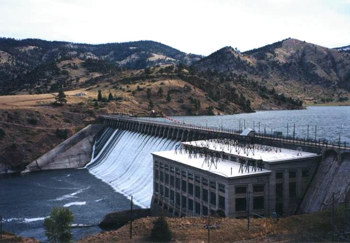
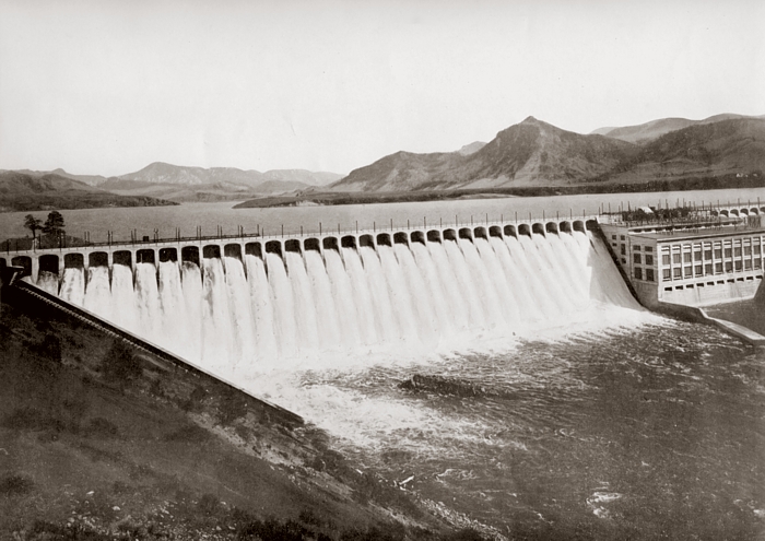
Holter
Dam, March 1918
Holter
Dam, about 1928
COURTESY
OF TOM KILMER • CLICK ON IMAGE FOR A LARGE
VERSION IN A NEW WINDOW